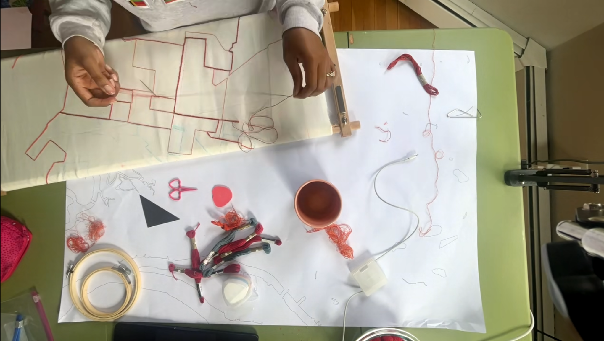
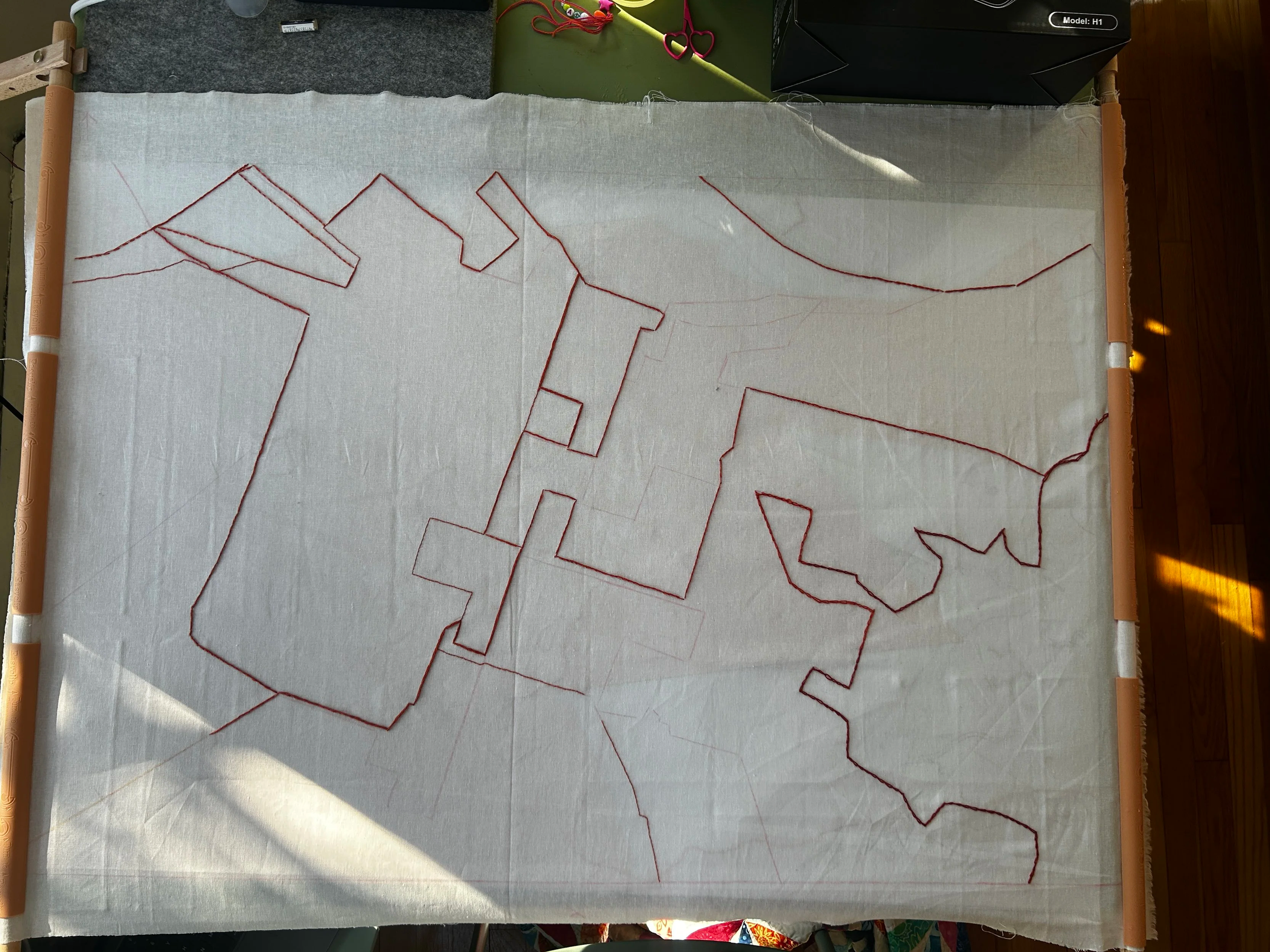
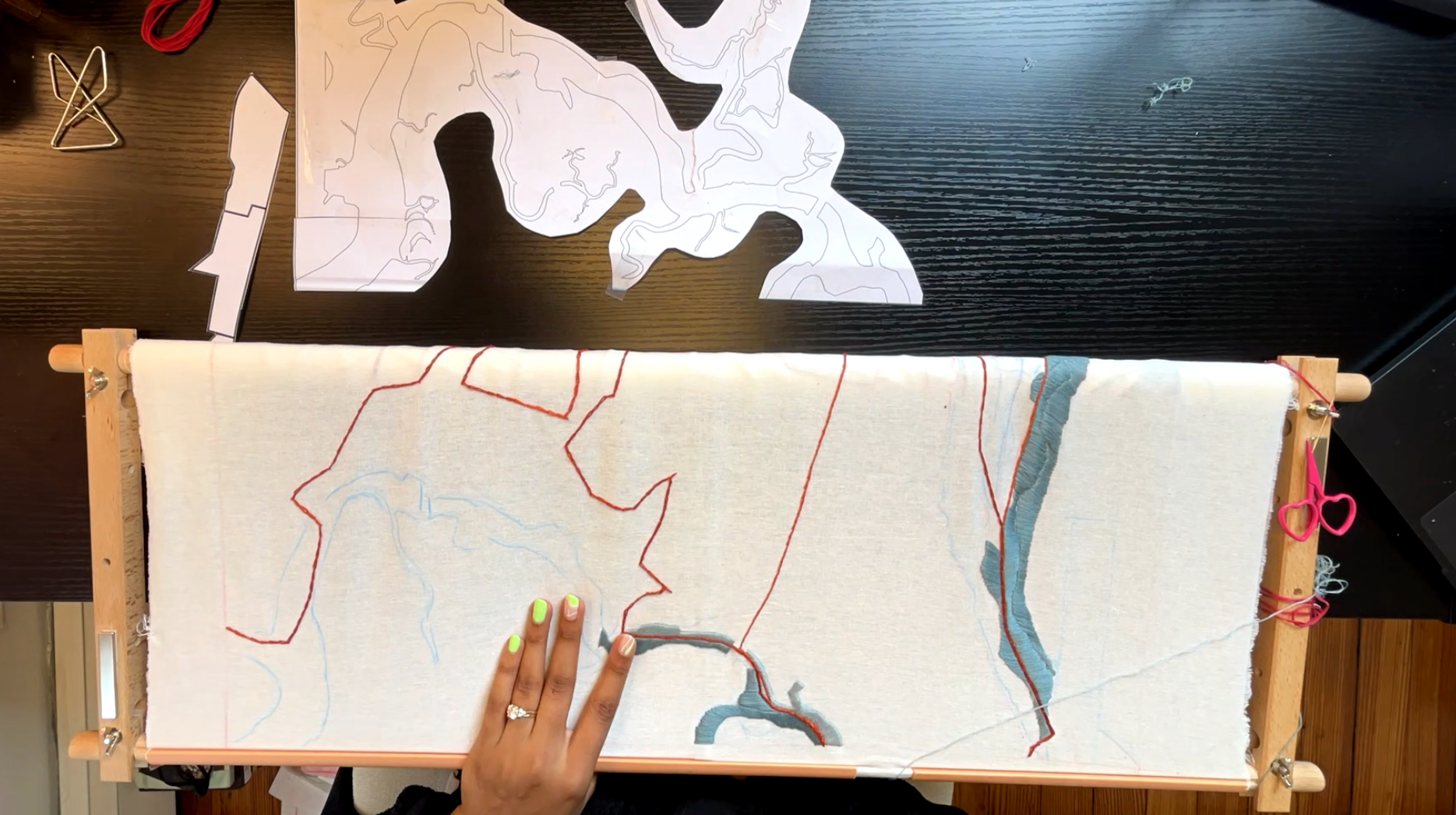
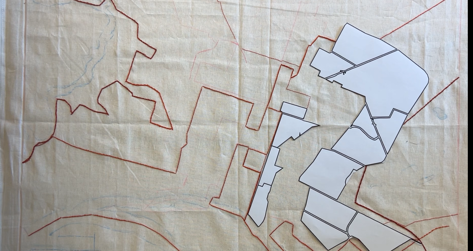
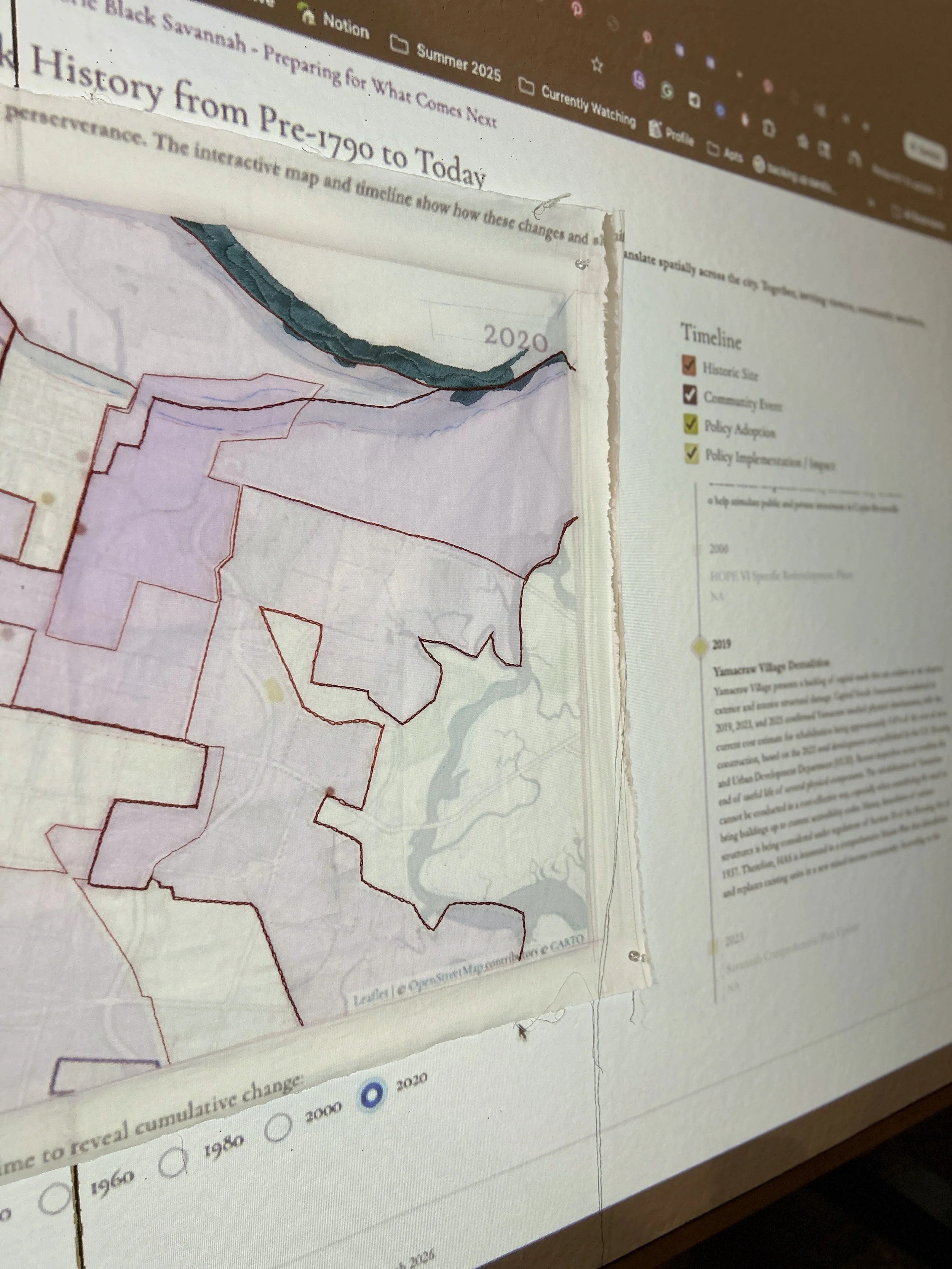
Threaded Cartography
Conceived as a way to capture Black Epistemologies through “new forms of knowledge and knowledge production through radical anti-racist forms of communal knowledge and spatial practice that are grounded in lived experience.” (Dark Matter U, n.d.), Threaded Cartography is a reparative, participatory, and tactile mapping practice that operates simultaneously as a counter-mapping strategy, a form of community knowledge production, and an archival intervention, which was developed specifically for this thesis. It weaves together spatial data, oral histories, and cultural memory to document and materially inscribe Black relationships to land, tenure, and place over time.
As a form of critical cartography, Threaded Cartography builds on longstanding assertions that maps are not neutral, but instead function as tools that produce and reinforce power. Inspired in part by W.E.B. Du Bois's Data Portraits: Visualizing Black America, which used data visualizations as a form of narrative correction, this practice intervenes in dominant mapping traditions by centering Black spatial narratives. While it draws on conventional planning tools such as site plans, zoning maps, land use maps, and parcel maps, it reworks their logics to construct a more comprehensive account of Black life and land relationships, here focused on residents of West Savannah, Georgia.
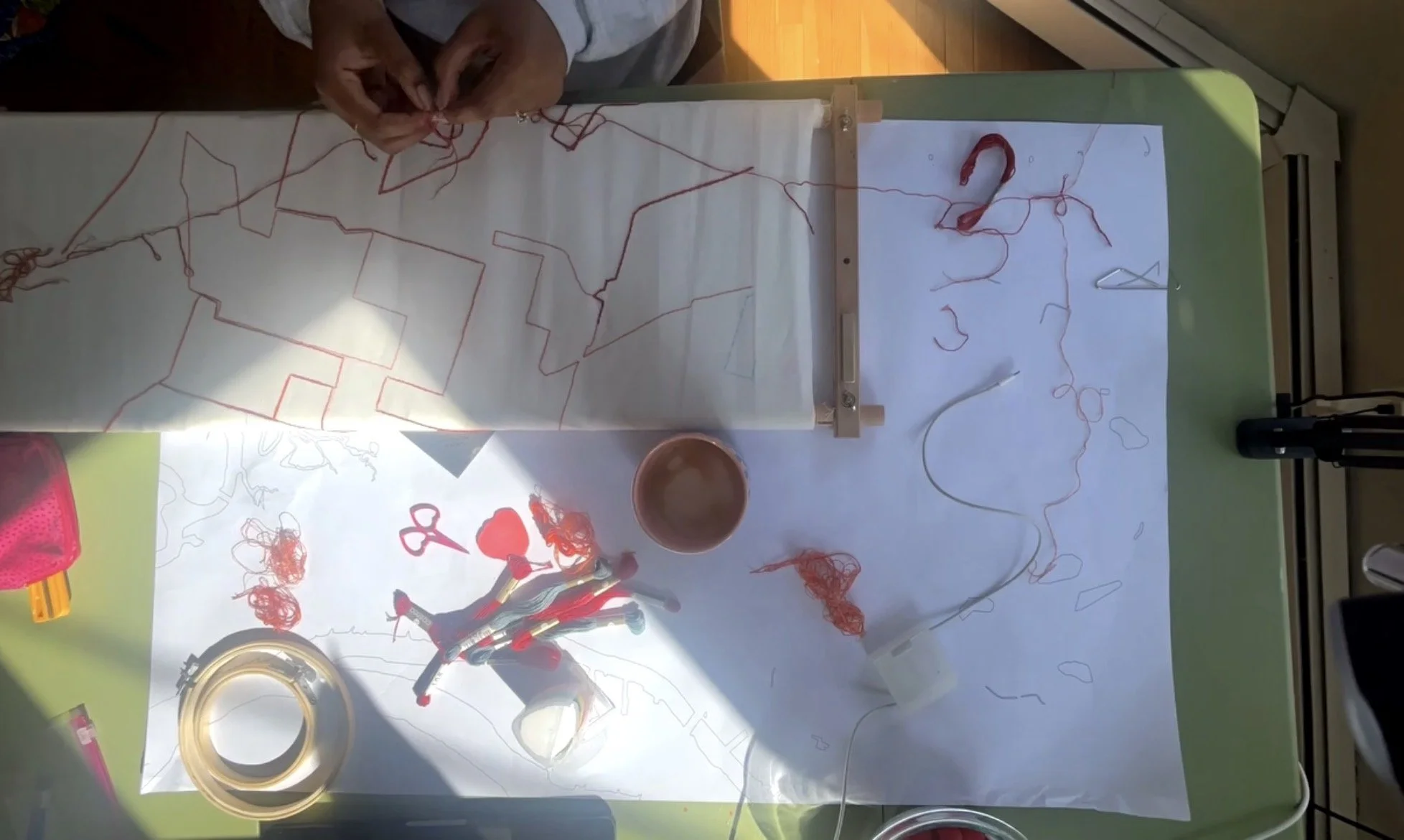
Traditional planning tools tend to be static, visual, top-down, and property-oriented, often privileging present and future conditions. In contrast, Threaded Cartography is process-based, tactile, and co-created. It is relationship-centered, historically grounded, and intergenerational in scope. In this way, it extends critical cartography into a materials-engaged, participatory practice that not only represents space but also actively reshapes how spatial knowledge is produced, heightening Firth’s argument that forms of critical cartography can be a “participatory pedagogical method” (Firth, 2014). Drawing on Christina Sharpe’s concept of Wake Work, Threaded Cartography operates within what she describes as “the continuous and changing present of slavery’s as yet unresolved unfolding”(Sharpe, 2016, p. 14). Within this framework, mapping becomes not a detached act of representation, but an ongoing engagement with histories that remain spatially and materially present. The act of stitching functions as a methodological intervention, slowing down the production of the map in ways we have departed from in contemporary, digital cultures. Embroidering requires embodied participation and makes the labor of remembering visible. The resulting textile records not only spatial information, but the tensions, ruptures, and continuities embedded within it.
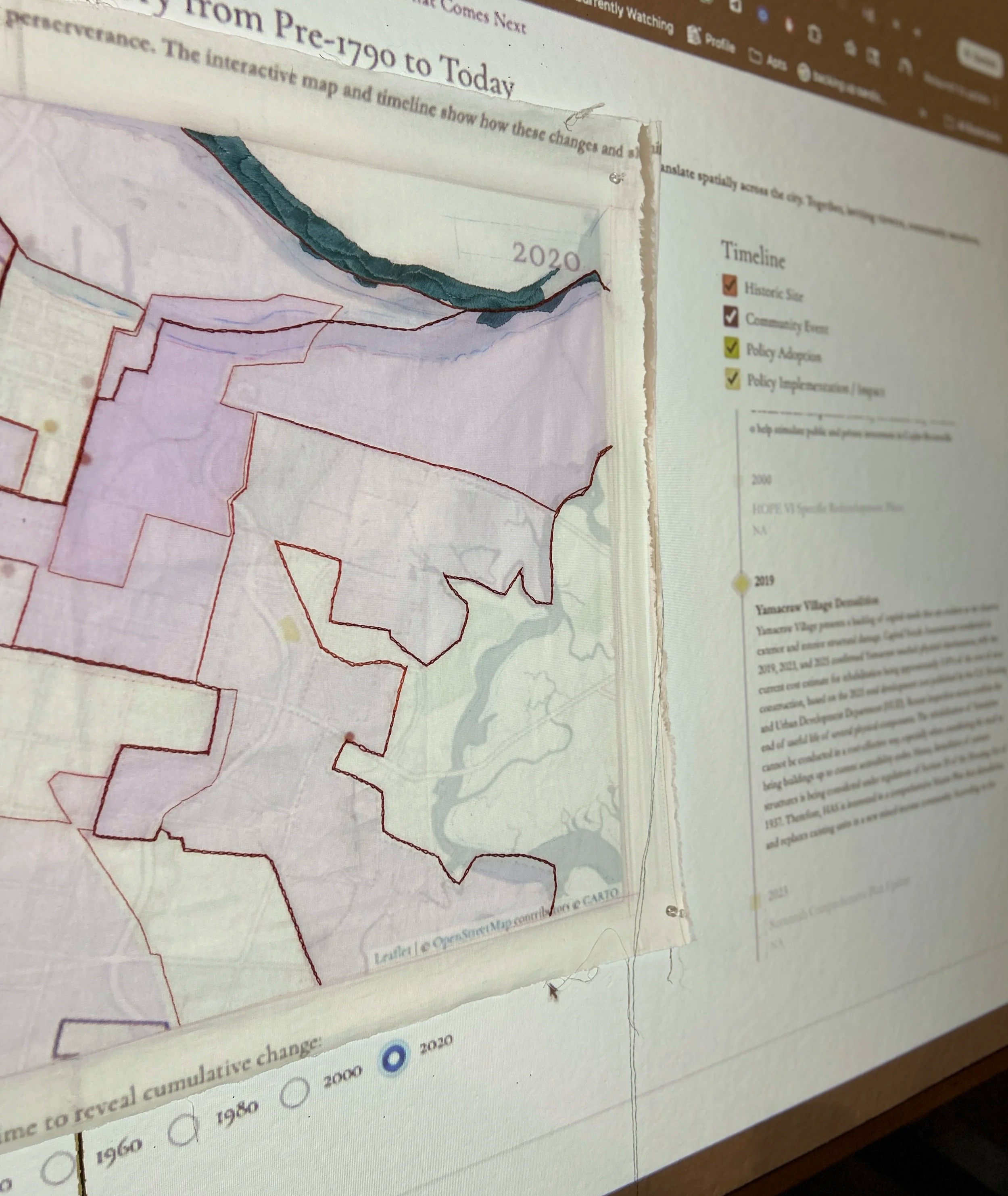
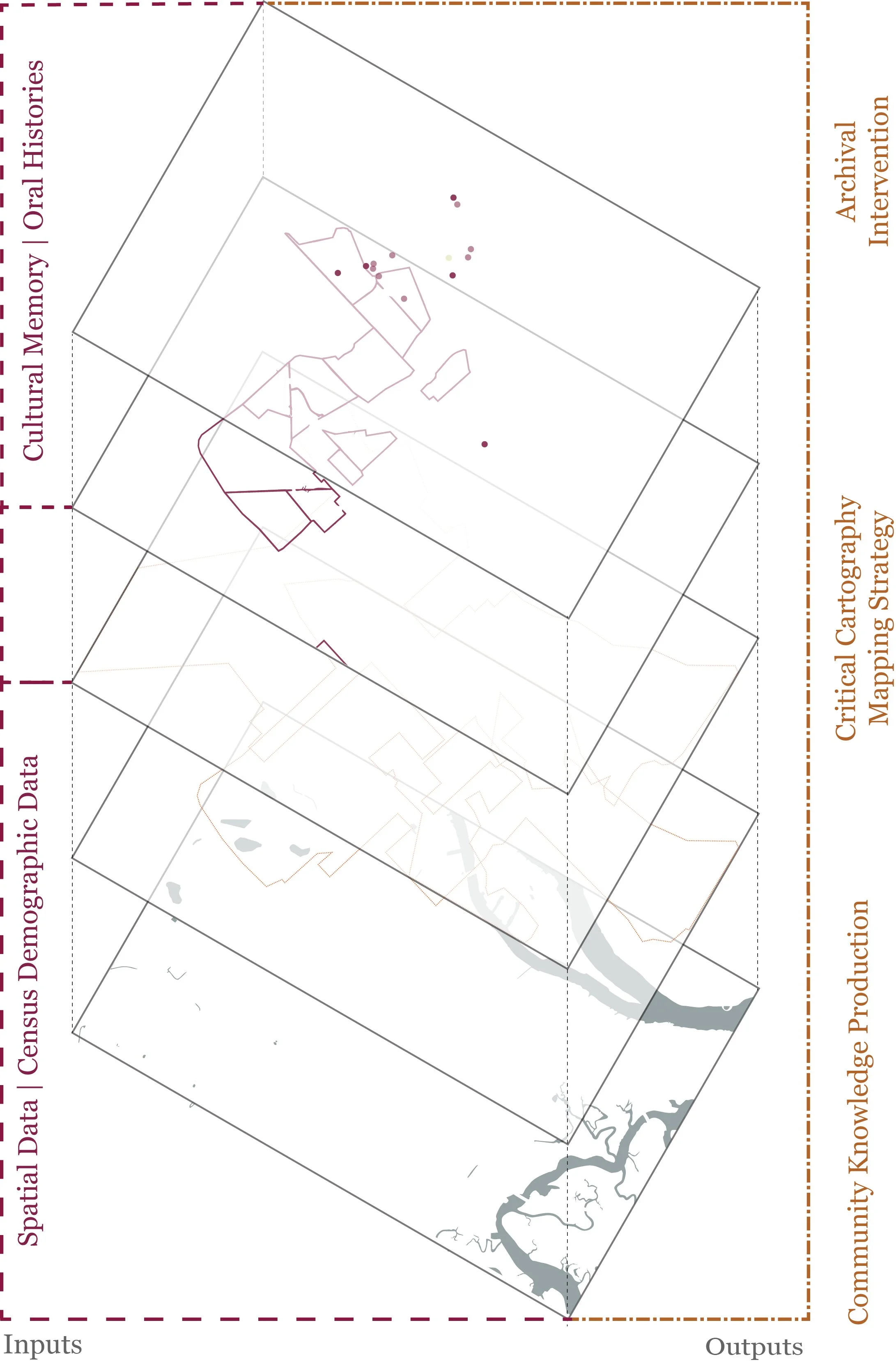
Central to this methodology is the positioning of oral history as spatial data and thus as a form of planning knowledge. Threaded Cartography asserts that oral narratives are not supplementary to mapped information, but are themselves a form of planning knowledge. These narratives document lived relationships to land, including spaces that may have never been formally recorded, yet remain materially and socially real. In doing so, this practice challenges dominant epistemologies that privilege written and technical documentation, foregrounding instead a form of knowledge production rooted in cultural memory and Black spatial practices.
By elevating oral history to the level of parcel lines, zoning designations, and land use classifications, Threaded Cartography expands the definition of legitimate spatial data. It creates a framework through which community memory, cultural identity, and lived experience become central to how space is understood, represented, and claimed. It creates a durable, community-held archive of land relationships and supports claims to space, tenure, and belonging. In this way, Threaded
Cartography not only documents space but also redefines who has the authority to map it, how it is mapped, and what forms of knowledge are recognized as valid within planning practice.